ANNAPURNA CIRCUIT TREK - DAY BY DAY
- Dec 6, 2018
- 26 min read
The Annapurna Circuit is one of the best hiking loops in Nepal and we love this loop a lot!

Jumping high on the way to Muktinath - Annapurna Circuit Trek
WHY HIKING THE ANNAPURNA CIRCUIT? DISCOVER MORE ABOUT ANNAPURNA CIRCUIT TREK HERE
First, you don`t get to see the same landscape twice – in particular, the landscape keeps changing along this hike and everyday it`s like walking a different trek: jungle, desert, pine forest, high mountain, local villages…
Second, the Annapurna range is so vast that you can basically walk a side trip almost every day – our absolutely favourite side trip was Lake Tilicho with its perfect lake reflections, its glaciers and surrounding mountains and its 5,000 m.
Third, the altitude gain along the Annapurna Circuit is quite gentle every day so it does give everyone time to acclimatize and enjoy the hike 100%.Last but not least, due to its longer duration and wider offer of accommodation and restaurants, the Annapurna Circuit never feels extremely crowded (except for the base camps which can become busy in very high season).
Here below is the detailed day-by-day itinerary we followed with all main information, such as altitude, duration / length of the hike and accommodation we used.
LEARN HOW TO PREPARE FOR THE ANNAPURNA CIRCUIT TREK HERE

Lake Tilicho magical reflections after a hard early morning climb to our first 5,000m!
DAY 1 - Kathmandu – Bensishar – Syange (1,100 m)
DURATION: 8 hrs
The first day was quite tiring and long for us and not because of too much walking - it took a whole day to reach the starting point of the track which was Syange for us. Some people start from Bensishar where the tourist or local bus from Kathmandu arrives (you can arrive here by private car as well but it will be much more expensive).
You have to book the bus from Kathmandu to Benshisar in advance and you will have an assigned seat on both local or tourist bus – it takes 7 hours to cover 173 km, but you`ll understand why as soon as you hit the road. The bus starts early in the morning (7am) from Balaju Bus stop and stops few times for breakfast, lunch and toilet breaks.
From Bensishar we took a 2-hour jeep to Syange – expect a very bumpy ride (the road is unpaved and full of holes and work in progress because of landslides) and be prepared to be squashed in the car. Try to bargain the price a little, however, most jeeps will charge NPR1,000 per person (we managed to pay half price only for our guide and porter).
Before taking the jeep remember to check in at the first check post of the track – just show your Annapurna Conservation Area Project leaflet and your TIMS card (which are better to obtain in Kathmandu – click HERE for more information) to the local check post which looks like this (picture below).
CLICK HERE TO FIND OUT HOW WE PACK FOR LONG TRIPS
ACCOMMODATION
Waterfall Guest House – Very nice accommodation with twin rooms, shared toilets and a beautiful waterfall just on the other side of the road. It can get noisy with the river and waterfall in the night but that’s actually very pleasant as it gives you the sensation of being completely immersed in nature. Food is good and at reasonable price.

Refreshing shot at Syange waterfall along the Annapurna Circuit Trek
DAY 2 - Syange (1,100 m) – Dharapani (1,860 m)
LEVEL: Long and Intermediate
LENGTH: 26 km
ELEVATION GAIN: 760 m
DURATION: 6 hrs
CLIMATE: Sunny / 15 to 25°C
Today was quite a long day but definitely panoramic the more we gained altitude. Our guide Dil took us along the drivable road until the village of Tal as this stretch of road gave us the opportunity of enjoying some beautiful vistas of the below valley and river and we could actually see the actual Annapurna Circuit trek which remains on the other side of the valley at a lower altitude (with somehow less viewpoints). The vegetation is mostly jungle and you might encounter some goats and small lizards along the road.The only downside were the jeeps passing along the road which were not many anyway.
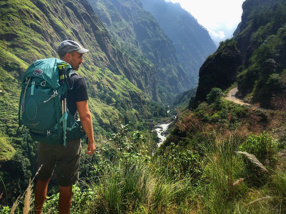
Can you see the Annapurna Circuit Trek on the other side?
We really enjoyed the wide view which we gained from the big bend along the road between Chamje and Tal. The Rainbow Falls (220 m), the highest in the Annapurna Range, were also quite spectacular and we had lunch in a restaurant with a great view over the village of Tal and its waterfall.
After lunch we rejoined the original Annapurna Circuit crossing the river to the other side and walking across Tal village which is very nice and dotted by buckwheat and millet fields. We also passed a suspended bridge over the powerful current of the Marshyangdi river to again rejoin the main drivable road to Dharapani.

Wonderful view of Thal Village and Annapurna Circuit Trek
Just before reaching Dharapani look at your right – you can not miss the suspended bridge linking two mountains at a way higher altitude than the valley you`re walking through. Dharapani offers several guest houses and it`s nice to walk around the village and see how local people live and say hello to children of course.
ACCOMMODATION
The 7 - Nice double room with en-suite bathroom – if you want hot shower, it’s outside in a closed cabinet for an extra charge. Wi-fi connection is not great but food is good and dining room is comfortable.

In the middle of the Himalayan jungle in Dharapani - Annapurna Circuit Trek
DAY 3 - Dharapani (1,860 m) – Chame (2,670 m)
LEVEL: Short and Intermediate
LENGTH: 21 km
ELEVATION GAIN: 800 m
DURATION: 4 hrs
CLIMATE: Drizzly and cloudy / 5 to 20°C
Today we got over 2,000 m and the temperature got definitely colder, also because of the rainy weather (the only rainy day out of our 15 day trek!). It was also quite harder than the previous day due to the first hour of steep ascent through the pine forest – the landscape starts to change into sub-alpine vegetation and houses in local villages are built with rocks. We stopped in Timang and Hoto villages which were fairly small but very nice for a tea break.
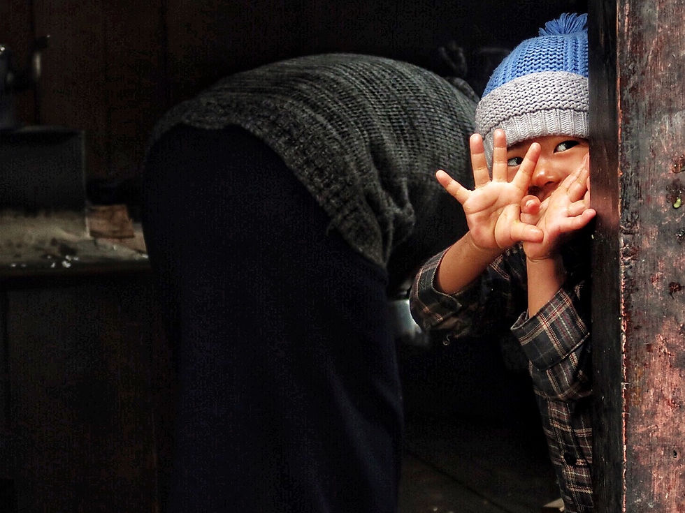
Playing Peek a Boo with a local Nepali kid in Timang Village - Annapurna Circuit Trek
Chame is bigger than the other villages but with more shops where you can already start stocking up on snacks and other gear you might need for higher altitude (more layers or gloves for example). There is also a suspended bridge with lots of Buddhist flags fluttering in the wind and some prayer wheels. If the weather clears up, you can see the first snow-covered peaks at a distance!
ACCOMMODATION
Moon Lake Guest House – Nice twin shared rooms with shared toilets and a small dining room – you can dry your clothes close to the fire stove. Food is good as always and position of the hotel is very central. We had a room facing the road, but you can ask for river view if preferred.

Finding peace in Chame - Annapurna Circuit Trek
DAY 4 - Chame (2,670 m) – Upper Pisang (3,300 m)
LEVEL: Short and Easy
LENGTH: 18 km
ELEVATION GAIN: 650 m
DURATION: 4 hrs
CLIMATE: Sunny / 5 to 15°C
Another amazing day reaching above 3,000 m. After passing a couple of nice local villages and a beautiful huge apple orchard (buy the apple fritter at the local shop), the track keeps following the river along a rocky wall with the view of an almost vertical and glittering mountain and past pine forests and suspended bridges.
Just after the trees start to be sparser, Dhikur Pokhari (3,060 m) is a perfect spot to sip a tea on one of the colourful restaurant roofs. From this village another 300 m uphill separates you from the stone village of Upper Pisang where the views of golden and red buckwheat fields are a great welcome to this awesome valley with Annapurna II (7,937 m) and Annapurna IV (7,925 m) as background. Enjoy a leisurely walk around the village and down to Lower Pisang up to the Buddha statue on the other side of the valley before dinner.
ACCOMMODATION
Manang Marshyangdi – Extremely nice accommodation in a wooden cabin with twin beds with amazing view of the below valley and the Annapurna II, III and IV. Pit toilets and shower are shared. Food is very good as well. Highly recommended!

Local women in a buckwheat field in Upper PIsang - Annapurna Circuit Trek
DAY 5 - Upper Pisang (3,310 m) – Manang (3,540 m)
LEVEL: Long and Medium
LENGTH: 26 km
ELEVATION GAIN: 240 m
DURATION: 6.5 hrs
CLIMATE: Sunny / 0 to 15°C
This was one of the longest days along the trek (almost 27 km!) and not on flat surface. You can take the main drivable road and cut this day to 3 hours, however you will miss some of the most beautiful views you can have of all Annapurna summits (except Annapurna South and Annapurna I which are only visible during the last part of Annapurna Circuit) plus you get the first glimpse of Tilicho Summit.
The start is the hardest: a steep climb up to 3,700 m to Gyaru Village (wait until you pass the first suspended bridge) but your efforts will be highly rewarded by the fantastic panorama on your feet with snow capped mountain summits framed by flowers, lots of fluttering Buddhist flags and an old smiley lady selling apple pies.

The Apple Lady and the Annapurna II on the background at Gyaru - Annapurna Circuit Trek
After the small stone village of Gyaru the trek offers you a very different view every hour – there are different paths you can take and if you take the longest, you will reach a big monastery and lots of stupas surrounded by the orange and yellow foliage of the trees in Autumn which only add to the magical atmosphere when you reach the monastery. We also saw our first Yaks, these big mountain bovid similar to bufalloes which can mostly found above 3,000 m in Central Asia, especially on the Himalayan region in Nepal and neighboring Tibet, as it is adapted to high altitudes.

Fantastic view of the monastery before descending to Manang - Annapurna Circuit Trek
From the monastery onwards a sandy trek descends all the way to a small village and the landscape turns into beige peaks of limestone shaped by wind and rain (they reminded us of the Bryce Canyon in USA). After the descent you will rejoin the main road for few kilometers before reaching Manang.
We had our lunch stop at the village of Ngawal (3,660 m) with panoramic view out to Annapurna III.

On the way to Manang amongst limestone pillars and Autumn bush - Annapurna Circuit Trek
Manang is a beautiful village where to stop for acclimatization (which is highly recommended after 3,000 m of elevation) – there are lots of small shops selling snacks, pastry, trekking gear and toiletries. There is even a cinema where they project movies about the Himalayas or survival such as "Everest" or "Into the wild".
ACCOMMODATION
Hymalayan Singi – Lovely stone guest house with its own garden and flowers all around. View of the Annapurna III from the restaurant and upper rooms. We had a comfortable 3-bed room – toilets are shared and hot shower comes at extra cost and not at full power. Ask them to light up the fire stove in the dining area in the evening as the temperature drops a lot when the sun sets – Wifi also does not work properly when the sun is not out as it’s solar powered. Bring a torch with you as electricity might be intermittent.

Nepali local kid in Manang village - Annapurna Circuit Trek
DAY 6 - Manang (3,540 m) – Acclimatization Day
LEVEL: Short and Easy
LENGTH: less than 2 km
ELEVATION GAIN: 210 m to Gangapurna Glacier Viewpoint
DURATION: 2 hrs return
CLIMATE: Sunny / 0 to 15°C
After the previous very long hiking day we took our time to explore the beautiful Manang valley at a slow pace. In the morning we climbed up to the viewpoint (3,750 m) of the Gangapurna Glacier (which summit reaches 7,454 m). As we were the first to walk along this trek we saw an undisturbed herd of blue mountain goats up close and enjoyed the amazing quiet of being up the top alone. Coming down we enjoyed the view of the ice-blue Gangapurna Lake even more.
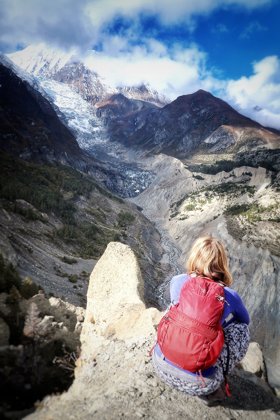
Contemplating majestic Gangapurna Glacier on our acclimatisation day in Manang - Annapurna Circuit Trek
Take your time to walk around Manang and reach the old part of the village with a 30 minute easy walk, where time seems to have stopped and life is based only on agriculture and pasture and therefore governed by seasons.
From Manang village another 15 minute walk takes you to Karkyu white gompa with views of the valley and the local life. We wanted to reach the cave monastery on top of this side of the mountain where the Hundred Lama is supposed to live – he will pray for your trek to go well in exchange of 100 NPR. Ask around the village if the Lama is in-house (it wasn’t when we were there) and prepare for a steep ascent to over 4,000 m.
ACCOMMODATION
Hymalayan Singi – See above for complete description.

Exploring old Manang village on our acclimatisation day - Annapurna Circuit Trek
DAY 7 - Manang (3,540 m) – Tilicho Base Camp (4,200 m)
LEVEL: Long and Medium
LENGTH: 18 km
ELEVATION GAIN: 660 m
DURATION: 4.5 hrs
CLIMATE: Sunny / -5 to 10°C
Another day in paradise! Starting from Manang well rested this day took us deeper into the Tilicho valley characterized by sandy and rocky terrain which can be quite slippery. The trek can also be very narrow in certain stretches. You will pass Shree Karka (which was the village where we were supposed to overnight, however we cut this section of the hike to 2 days instead of 3 after discussing with our guide DIl) in approx. 2.5 hour hike and then Khangsar village on the way to Tilicho Base Camp which comes into view only during the last 30 minutes of the walk.
Highlights are the surrounding mountains, high rushing waterfalls and yaks and horses along the path (make space for them well before you cross their path as they stop at nothing =) )
TIP – Start early this morning to reach the base camp around lunch time, it will be already quite busy in high season as many people stop here for acclimatization before attempting Tilicho Lake.
ACCOMMODATION
Tilicho Base Camp – Basic twin room with shared toilets. Temperature is quite cold in the night so ask for an extra blanket if you can. Food is good and there’s a fire stove to warm up the dining room in the evening.

Curious yak on the way to Tilicho Base Camp - Annapurna Circuit Trek
DAY 8 - Tilicho Base Camp (4,200 m) – Tilicho Lake (5,000 m) – Shree Karka (4,060 m)
LEVEL: Long and Hard
LENGTH: 22 km
ELEVATION GAIN: 964 m to Tilicho Lake
ELEVATION LOSS: 954 m to Shree Karka
DURATION: 2.5 hrs return to Tilicho Lake + 2 hrs to Shree Karka
CLIMATE: Sunny / -10 to 15°C
5.30 am start this morning to make sure we tackled the hardest part of the ascent to Tilicho Lake (5,000 m) not under the heat of the sun. This early in the morning in October visibility is good so you don`t really need a head torch.
The good thing of basing yourself at Tilicho Base Camp is that you can leave your backpacks at the camp and climb up to the lake light and early in the morning.
Breathing gets harder and harder the higher you go and you have to stop frequently when you hit the steepest part of the hike, a zigzagging rocky and sandy path – make sure you drink plenty of water, bring lots of layers (and take them off or put them on as temperature changes) and take some snacks with you. Our guide gave us a push when he took out of his bag two energy bars just before the zig-zag!
The view keeps improving the higher you go and it’s such a nice feeling when the sun rises and illuminates the path – when you finally reach Tilicho Lake at 5,000 m, the reflection of the surrounding mountains and glaciers into the lake are surreal on a clear day when the wind is not blowing. From here you can continue on an alternative trek which passes throughout the Mesokanto-La Pass (5340 m) and descends to Jomsom valley with spectacular views of Lower Mustang and Upper Mustang valley.

Unbelievable reflections into Tilicho Lake at 5,000 m - Annapurna Circuit Trek
After descending from Tilicho Lake we had a big breakfast before starting walking again towards Shree Karka along the same rocky road we came from the previous day – still the landscape doesn’t stop to wow us at every turn.
This was the only day I had headache for the whole evening and didn’t have much appetite, however after taking an aspirin, everything went away and I felt great the next morning.
ACCOMMODATION
Tilicho Peak Hotel – Nice stone guest house with twin shared rooms and shared toilet. Dining room is very warm during the day (the seats along the big windows are nice and cozy). Food is good however wi-fi is not working properly. No charging sockets in the room, so you`ll need to charge your mobiles, e-books, etc. in the dining room.

First glimpses of sun along Tilicho Lake trail - Annapurna Circuit Trek
DAY 9 - Shree Karka (4,060 m) – Ledar (4,200 m)
LEVEL: Short and Medium
LENGTH: 17.5 km
ELEVATION GAIN: 140 m
DURATION: 3.5 hrs
CLIMATE: Sunny / -5 to 10°C
Today we exited the Tilicho valley following the signs for Yak Kharka. After an hour of gentle uphill (it was quite freezing), we got to a fantastic viewpoint where the Tilicho valley meets the Manang valley and from where you can see the beautiful village of Manang in the distance. Here a sharp left turn leads you to a 30 minute descent towards the river below – you can see the landscape changing from red and yellow sparse scrubs at higher altitudes to an autumn color palette of trees at lower altitudes.
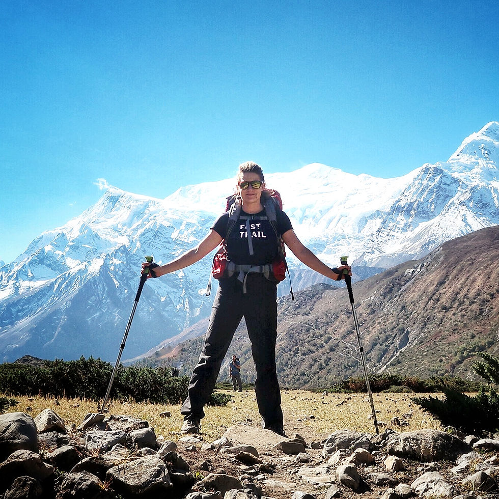
Saying goodbye to the Annapurna Range before reaching Ledar - Annapurna Circuit Trek
Once we reached the river, we passed the suspended bridge and enjoyed a warm tea before a short ascent to join the Annapurna Circuit trek once again. From here we reached Ledar in 2 hours walking along a mostly flat and sandy path, leaving the peaks of Annapurna III, IV and II back and meeting lots of fluffy Yaks.
ACCOMMODATION
Hotel Dhading Laxmi - Very well positioned guest house with all rooms lined up on the village ridge with panoramic views out to icy peaks which turns pink and orange at sunset and sunrise. Basic shared toilets and small cozy dining room with a warm fire stove (make sure you don’t stay too close to it as it can get extremely hot). Food and tea are simple but very good as always.

Autumn colours between Tilicho Base Camp and Shree Karka - Annapurna Circuit Trek
DAY 10 - Ledar (4,200 m) – Thorong La High Camp (4,925 m)
LEVEL: Short and Medium
LENGTH: 11.5 km
ELEVATION GAIN: 725 m
DURATION: 2 hrs 45 mins
CLIMATE: Sunny / -5 to 10°C
An early start today even though we only walked almost 3 hours in total – although Thorong La High Camp can host approx. 200 people, it gets so crowded by early afternoon that you might not find any more beds if you arrive too late in the day.
It took us approx. 2 hours to reach the extremely small village of Thorong Pedi (where we were originally supposed to overnight, but we changed the plans with our guide once again), passing through a beautiful mountainous valley still following the river below. It`s not a hard hike but you can feel the high altitude at every breath you take and every small uphill will slow you down.
At Thorong Pedi take your time to sip a warm tea before you tackle the last part of the trek to the high camp which is reasonably steep and takes you from 4,600 m to 4,925 m.
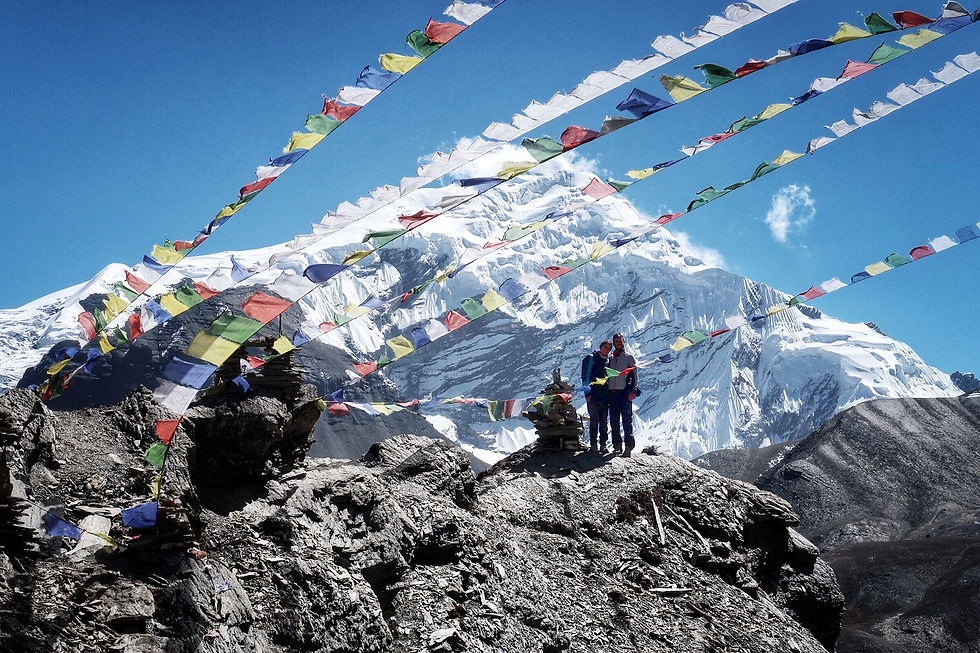
Love on the top of the Throng La High Camp - Annapurna Circuit Trek
Once at the top don’t miss the short ascent to the Buddhist flags on top of the rocky edge which looks down to Thorong Pedi and out to stunning mountain peaks and waterfalls – no words can do justice to this stunning natural sight!
TIP – Drink, drink, drink (water or tea, mind you =) ) The more you keep your body hydrated, the better you will cope with high altitude.
ACCOMMODATION
Thorong La High Camp – The small stone rooms of this camp are twin shared and lined up all around the main building where the kitchen, dining rooms and porters/guides’ rooms are located. There are very basic pit toilets and a big water tank outside. Food is good and the atmosphere is lively.

Happiness on the top at Throng La High Camp - Annapurna Circuit Trek
DAY 11 - Thorong La High Camp (4,925 m) – Thorong La (pass) (5,416 m) – Muktinath (3,800 m)
LEVEL: Long and Hard
LENGTH: 19 km
ELEVATION GAIN: 491 m to Thorong La (Pass)
ELEVATION LOSS: 1,616 m to Muktinath
DURATION: 1 hr 45 mins to Thorong La + 3.5 hrs to Muktinath
CLIMATE: Sunny / -5 to 10°C
Finally, the day we waited so much for came! The night was sleepless because of the high altitude, in addition start time was at 4.30 am today after a quick breakfast. Armed with head-torch and all our warm layers we started a very slow ascent to Thorong La (“La” means mountain pass in Nepali language), the highest point of the Annapurna Circuit which leads you to the Mustang Valley. It was our first time walking up a mountain with pitch black and it actually helped us ascent faster because we didn’t stop many times as it was dark and it was particularly cold (we recommend a warm pair of gloves and beanie). The flashlights piercing the dark along a track you can’t even see is quite an experience. We didn’t drink much either as our water froze inside our water bottles and inside the mouthpiece of our backpack bladder – luckily, there is a very small teahouse at the pass where we got a warm tea and lots, lots of biscuits and energy bars.

Enjoying hot tea and biscuits at Throng La (pass) after a freezing climb - Annapurna Circuit Trek
It’s difficult to describe the feeling of reaching Thorong La after almost 2 hours of darkness and fatigue and then watch the sun rise slowly and its dim pink light melting over the snowy mountain peaks surrounding the pass. There was no snow on the track in October however the snow level basically started from 5,000 m. We were almost the first ones to arrive after a group of 4 Russians and a couple of friends met during the hike so our arrival was even more emotional, enjoying the pass with few people.
TIP – All guides usually recommend hikers to arrive at Thorong La before 9am after which the wind usually starts to blow stronger; in addition, hiking up in the darkness helps you mentally as you don’t feel the need to stop much during the ascent and you basically keep going.

Breathing pure air at Thorong La (pass) at 5,416 m - Annapurna Circuit Trek
After 30 minutes of freezing cold at Thorong La we resumed our walk, this time more than 1,600 m of elevation loss through a beautiful deserted valley leading to Muktinath. The trail is quite steep and slippery at times so we recommend hiking poles to make it easier on your knees. There are a couple of teahouses on the way but they were all closed except one in the morning when we passed. On this side of the trek the landscape is much drier with no green trees but only red and yellow patches of scrubs and bushes in sharp contrast with the snowy mountains on the background.
Muktinath is not a particularly beautiful village however it does have a couple of interesting temples to visit - Chumig Gyatsa Temple and Narsing Gumpa (with a golden Buddha statue on top).
Chumig Gyatsa which is a religious symbiosis between Hindu and Buddhist religions, is a very frequented temple where believers come in pilgrimage to purify themselves (you can see them coming by horse sometimes) - there are 108 waterspouts in the backyard of this temple called as Muktidhara where frozen water is continuously flowing from the bullhead and two Kunda (ponds in front of the temple). Taking bath in these 108 waterspouts and two Kunda (ponds) believes to bring salvation.
You can reach both sites with a leisurely walk after lunch and take in the view of the Mustang Valley.
ACCOMMODATION
Path of Dreams – They have both twin and double rooms with Western-style toilets and hot shower. No view out of the window (at least from the rooms in the basement). Nice dining room with television and decent wifi connection. Only downside is breakfast food and deserts – the apple pie and the chocolate pancake were some of the most tasteless (or better worst tasting) we had along the trek. Chichen curry and other main dishes were actually all right, but overall nothing special.

Nursing Gumpa in Muktinath - Annapurna Circuit Trek
DAY 12 - Muktinath (3,800 m) – Kagbeni (2,800 m)
LEVEL: Short and Easy
LENGTH: 15 km
ELEVATION LOSS: 1,000 m
DURATION: 2.5 hr
CLIMATE: Sunny / 10 to 15°C
Today was a relaxing hike all downhill to Kagbeni, a small unique village embedded in a bend of the Kali Gandaki River – we followed the Annapurna Trek along open meadows and crossing tiny streams of water until we met the paved road which took us to Kagbeni. The view of the “desert of Nepal” is quite spectacular, especially if you are coming from the much greener area of the Manang valley. There is very few vegetation and the small mountains around are all dusty and striped apart from the triangle of green plantations in Kagbeni.

Kagbeni village from above and the desert of Nepal in the background - Annapurna Circuit Trek
The wind usually takes off with strong gusts from midday onwards and only the mud walls of Kagbeni village keeps you sheltered from it – we recommend you explore the village slipping through every tiny alleys you can find and peaking over the house walls. We found some interesting statues and door decorations made with yak horns and we had some encounters with locals carrying on their daily life, working in the fields, carrying heavy burdens or chatting with each other in secluded corners.
ACCOMMODATION
Annapurna View Hotel – Very nice accommodation with open views of the valley below and the surrounding mountains. They have private rooms with twin beds and private bathroom and hot shower or dorm-style rooms for bigger groups with shared toilet – clean and warm. Food is very nice and the atmosphere is very relaxing.They have both twin and double rooms with Western-style toilets and hot shower. No view out of the window (at least from the rooms in the basement). Nice dining room with television and decent wifi connection. Only downside is breakfast food and deserts – the apple pie and the chocolate pancake were some of the most tasteless (or better worst tasting) we had along the trek. Chichen curry and other main dishes were actually all right, but overall nothing special.

Exploring Kagbeni village - Annapurna Circuit Trek
DAY 13 - Kagbeni (2,800 m) – Jomson (2,720 m)
LEVEL: Short and Easy
LENGTH: 12 km
ELEVATION LOSS: 80 m
DURATION: 2.5 hr
CLIMATE: Sunny / 15 to 20°C
Another short and easy hiking day with almost no elevation gain. From Kagbeni make sure to take the Annapurna Circuit hiking trail and not the main road – you will walk along a dusty trail passing an almost deserted village. After a very short ascent we rejoined the main sandy road and herds of goats were keeping us company the whole way. Again the landscape is characterized by desert and bare mountains.
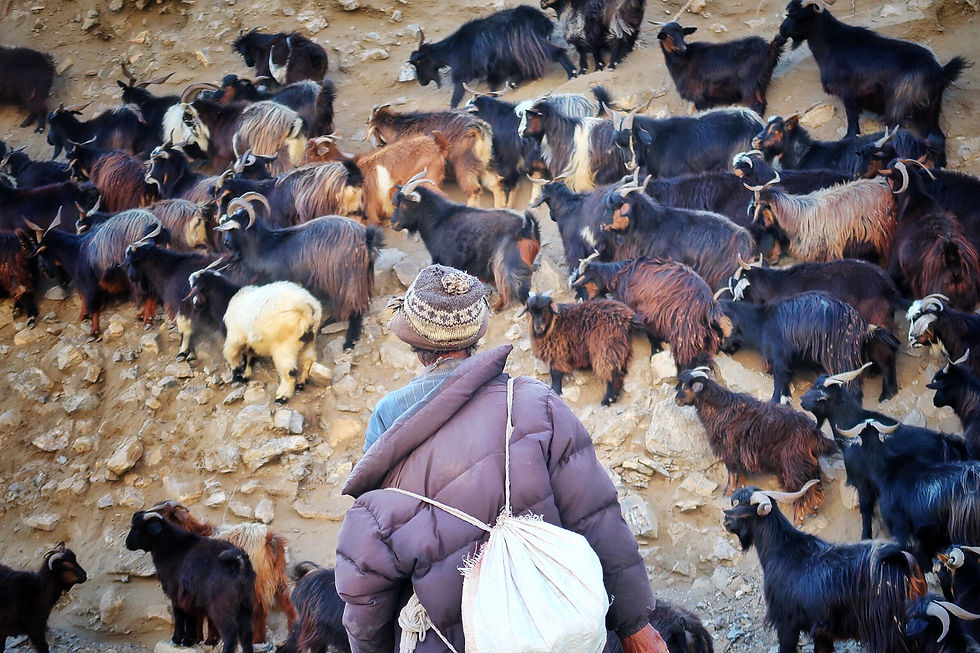
Local shepherd with a herd of goats - Annapurna Circuit Trek
Jomson is not particularly beautiful – a very long dusty road passes through the dusty village and it’s only famous for its small airport from where all planes from/to Pokhara take off or land, usually in the morning as the wind is usually very strong from midday onwards.
We spent our afternoon exploring the surrounding area which was very peculiar. We continued along the Annapurna Trek until we reached Dhumba Lake (you have to pay a small entrance fee – however you can see the lake from the trek as it’s all there!). Then we walked back the same way and continued uphill to the white village of Thili where there are lots of apple orchards, delicious! We only met few people including some local children who wanted to speak some English and were so happy when we gave them candies. We then returned to Jomson taking a shortcut through the dry fields which separate Thili village from one of the bridges which cross the river to Jomson.
ACCOMMODATION
Hotel Tilicho – Nice hotel with shared twin bed accommodation. The rooms inside the main building are not very private as the only windows face the main passage way to all other rooms, but there are curtains. Pit toilets and showers are simple but clean. Good food and views of the mountains and planes taking off from the airport from the roof top backyard.

Nepali local kids in Thili village after they got some candies - Annapurna Circuit Trek
DAY 14 - Jomson (2,720 m) – Tatopani (1,200 m) by bus
LENGTH: 62 km by bus
ELEVATION LOSS: 1,520 m
DURATION: 4 hr
CLIMATE: Sunny / 15 to 25°C
Today we barely walk as we took the local bus from Jomson at 7am (which stopped almost in front of our hotel) to Tatopani. Luckily Fabio realized he left his camera on the table in the hotel after 5 minutes ride so our guide Dil promptly jumped out of the bus and rescued it (he then had to take a later bus to Tatopani) – this was one of the many cases where we were so happy to have taken a guide!
Our porter Zhanna was a little worried to have been left alone with us on the bus as he could not speak English so he freaked out when we ran out of the bus at one of the stops to go to the toilet.
At the end of the ride at 11am we got off the bus completely destroyed – we probably would have preferred to walk the two days that separate the two villages instead of experiencing the most bumpy bus ride ever in our life! This is not for the faint-hearted – the road is very narrow and the bus drivers drive very fast on this uneven and unpaved surface. Sometimes they stop abruptly to let motorcycles or other buses passing and pass extremely close to either the rocky wall on one side or the overhang on the other side. If you`re scared of heights, don`t sit on the left side of the bus as you will be constantly looking out at the overhang.
Tatopani is a tiny village with not much to see or do – there are hot pools along the river however the temperature here is very warm and these pools are not extremely inviting (you have to pay a fee to enter and use them). So we just relaxed the whole afternoon at the hotel looking forward to the next few days of hiking.
ACCOMMODATION
The Old Kamala – Very nice hotel close by the main bus stop In Tatopani. It offers private rooms with twin shared bedding and private bathroom with hot showers. Food is very nice and there is a small bakery just opposite the hotel which serves very nice cakes and muffins. If it’s not raining, it’s nice to dine in the outside area. Nice hotel with shared twin bed accommodation. The rooms inside the main building are not very private as the only windows face the main passage way to all other rooms, but there are curtains. Pit toilets and showers are simple but clean. Good food and views of the mountains and planes taking off from the airport from the roof top backyard.
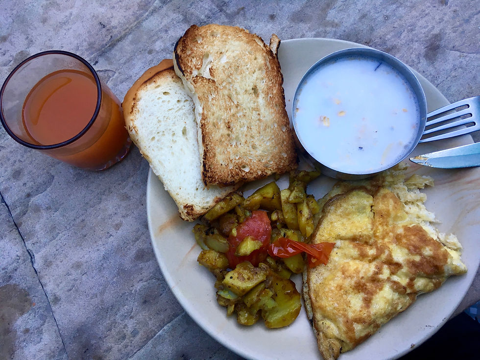
Delicious breakfast in Tatopani - Annapurna Circuit Trek
DAY 15 - Tatopani (1,200 m) – Ghorepani (2,870 m)
LEVEL: Long and Hard
LENGTH: 20 km
ELEVATION GAIN: 1,700 m
DURATION: 5 hrs
CLIMATE: Sunny during the day and Foggy in the evening / 5 to 15°C
Brace yourself for one of the longest and hardest hiking day of the whole trek – though altitude is not an issue here, 1,700 m elevation gain up steep, uneven steps will test your legs and lungs. The first part of the trek is actually really nice with beautiful views of the valley below during the first two hours until you reach the other side of a lush green hill where you start looking out to another valley at the end of which you will finally reach Ghorepani. Don’t get fooled when you see the first hotel in Ghorepani as the village is all uphill and you might have to walk another 20 minutes to reach your hotel.
We really enjoyed passing through the villages along this part of the trek – villagers here live a little bit differently from other valleys visited so far and particularly around the middle of October they were all butchering buffaloes in the open air in preparation for the big Hindu festival of Dashain. Although most people in this valley are Buddhists, the whole country celebrates this festival which lasts 2 weeks and it’s an occasion for local communities to eat meat (which is considered a delicacy and it’s a rare find as expensive and not available throughout the year).

Old farming technique on the way between Tatopani and Ghorepani - Annapurna Circuit Trek
We made a couple of stops for tea break and lunch along the way at Super View Restaurant and at New Dhalaugiri Lodge and Restaurant from where you can dine facing the beautiful Dhalaugiri mountain (8,167 m, the 7th highest mountainin the world).
Unfortunately it was foggy in the evening so we could not enjoy the views of surrounding mountains from Ghorepani. The temperature got definitely colder here.
ACCOMMODATION
Kamala Hotel – a wooden multi storey hotel with a cozy atmosphere in the village centre. If you aim to be closer to the start of the Poonhill walk, then opt for the hotels in the upper part of the village which are slightly more expensive but they have great mountain views and bigger rooms and restaurants. Our room was private twin bed with shared toilet. Hot shower was available at extra cost but it was in a very small and basic room. Food was nice and simple and the dining room has a fire stove where you can hang some clothes to dry.

A foggy evening in Ghorepani - Annapurna Circuit Trek
DAY 16 - Ghorepani (2,700 m) – Poonhill (3,200 m) – Nayapul (1,070 m) – Pokhara (800 m)
LEVEL: Long and Medium
LENGTH: 25 km + Minibus to Pokhara
ELEVATION GAIN: 330 m to Poonhill
ELEVATION LOSS: 2,100 m to Nayapul
DURATION: 5 hrs
CLIMATE: Sunny / 0 to 20°C
Another beautiful and long day! We woke up at 5am to line up for the most famous hike in the Annapurna range – the climb from Ghorepani to Poonhill to see the sunrise from the top which is really worth it. Unfortunately, this hike is also very busy so we had to pass many hikers making ourselves space through the crowd. Make sure to bring water and an extra layer as it can get chilly up the top while you are waiting for the sunrise and you`re all sweaty from the hike.
TIP - There is a NPR100 entrance fee per person before starting to climb up to Poonhill. The guards are only there between 5am and 7am and not during the day so if you have more time during your stay in Ghorepani, you might consider walking up mid morning or after lunch if it’s a sunny clear day.
From Poonhill you can see some of the world’s highest peaks with Annapurna I (8,091 m), Annapurna South (7,219 m), Dhaulagiri (8,167 m) and the very particular Fishtail Mountain (6,993 m) which is a sacred mountain to a Hindu deity and therefore no one is allowed to climb it. Experiencing the sunrise from here is particularly beautiful even though you have to share it with probably too many hikers.
After returning back to Ghorepani we had breakfast at our hotel and then started the long descent to Nayapul – 2,100 m of elevation loss which you will feel on your legs in the next days. We highly recommend hiking poles as they can save your knees from injuries. You will pass lots of small colourful villages and the vegetation will become greener and greener. This part of the Circuit is definitely busier than any other part we hiked as this is part of the Annapurna Base Camp trek which is much more popular than the Circuit. In addition, many people are only walking until Poonhill and then back the same way.
During Spring all rhododendron trees (which are one of the symbols of Nepal) are in bloom and it must be a very special view. There are lots of rice fields particularly during the last part of the trek just before passing a couple of bridges over the Modi river. Nayapul village is nothing special but it’s a welcomed sight after the very long descent.
From Nayapul our hotel picked us up by minibus and in one hour we got to busy Pokhara, which has quite a completely different vibe from Kathmandu. It seems this city is built around tourists with lots of modern shops and restaurants and very expensive and Westernized hotels. We had a good pizza in town to celebrate our last day of hiking.
ACCOMMODATION
Fewa Holiday Inn – One of the best accommodations along the track as located in Pokhara which is quite a fancy city in comparison to Kathmandu. We had our private rooms (twin bed) with Western style en-suite bathroom, bottled water and toilet paper! Keep the curtains close for privacy as the hotel is surrounded by other tall buildings. Dinner was not included so we went out to a restaurant. Breakfast was included (eggs, toasted bread and jam) and served after 6.30am – nothing special but filling enough.a wooden multi storey hotel with a cozy atmosphere in the village centre. If you aim to be closer to the start of the Poonhill walk, then opt for the hotels in the upper part of the village which are slightly more expensive but they have great mountain views and bigger rooms and restaurants. Our room was private twin bed with shared toilet. Hot shower was available at extra cost but it was in a very small and basic room. Food was nice and simple and the dining room has a fire stove where you can hang some clothes to dry.
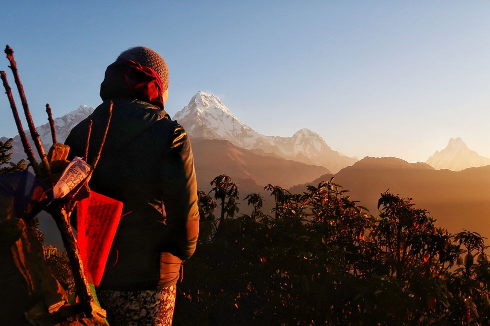
Amazing sunrise from Poonhill - Annapurna Circuit Trek
DAY 17 - Pokhara – Kathmandu
DURATION: 7 hrs
After the included breakfast at our Pokhara hotel and a big hug to our guide and porter (who met their next clients in Pokhara) the hotel arranged a taxi ride (included in our hiking package) to the main bus stop for tourist buses which is not walking distance from the main city centre. Here we got on our bus but our names were not in the passengers’ list so we had to contact our Pokhara hotel and the owner reconfirmed our booking (this was probably the only fault of our organized package which was solved with only a quick phone call though).
The bus ride from Pokhara to Kathmandu is quite long and with no particular views along the way, apart from some glimpses of the mighty Trishuli River which flows along the road for many kilometers until the bus reaches Kathmandu district. We left at 7.30am from Pokhara, stopped in a couple of places for lunch and snacks (not included in the price this time as specified in our hiking package) and arrived in Kathmandu around 2 pm in the afternoon. There were some taxi drivers around the bus, but we were not exactly sure if the taxi ride to our Kathmandu hotel was included in our package (possibly another fault of this day) which didn’t really matter at the end as we decided to walk the short distance to our hotel in Thamel.
ACCOMMODATION
Yala Peak Hotel – Great hotel situated in the middle of Thamel in Kathmandu. This is run by the owner of Mount Trail (the company we used for the Annapurna Circuit) and has an onsite restaurant (Rosemary Kitchen and Coffee Shop) which is fancier and more expensive than Yala Café, just closeby which serves very similar dishes but for less and has good internet connection and great service and food. Our room was one of the best (included in our package) on top of the hotel with double bed (great mattress), private bathroom and air con – all quite luxurious in comparison to the accommodation standards of Kathmandu. Highly recommend for your final night in Kathmandu after a long multi-day hike!

Beautiful rhododendron forest from Ghorepani to Nayapul - Annapurna Circuit Trek
ANY QUESTION? PLEASE CONTACT US AT OUR EMAIL (info.seekfindexplore@gmail.com)
WE WILL BE HAPPY TO HEAR YOUR COMMENTS OR GIVE YOU MORE INFO OR JUST CHAT =)


Comments